

History of the Track, Ridge, Grasshopper Neighborhoods
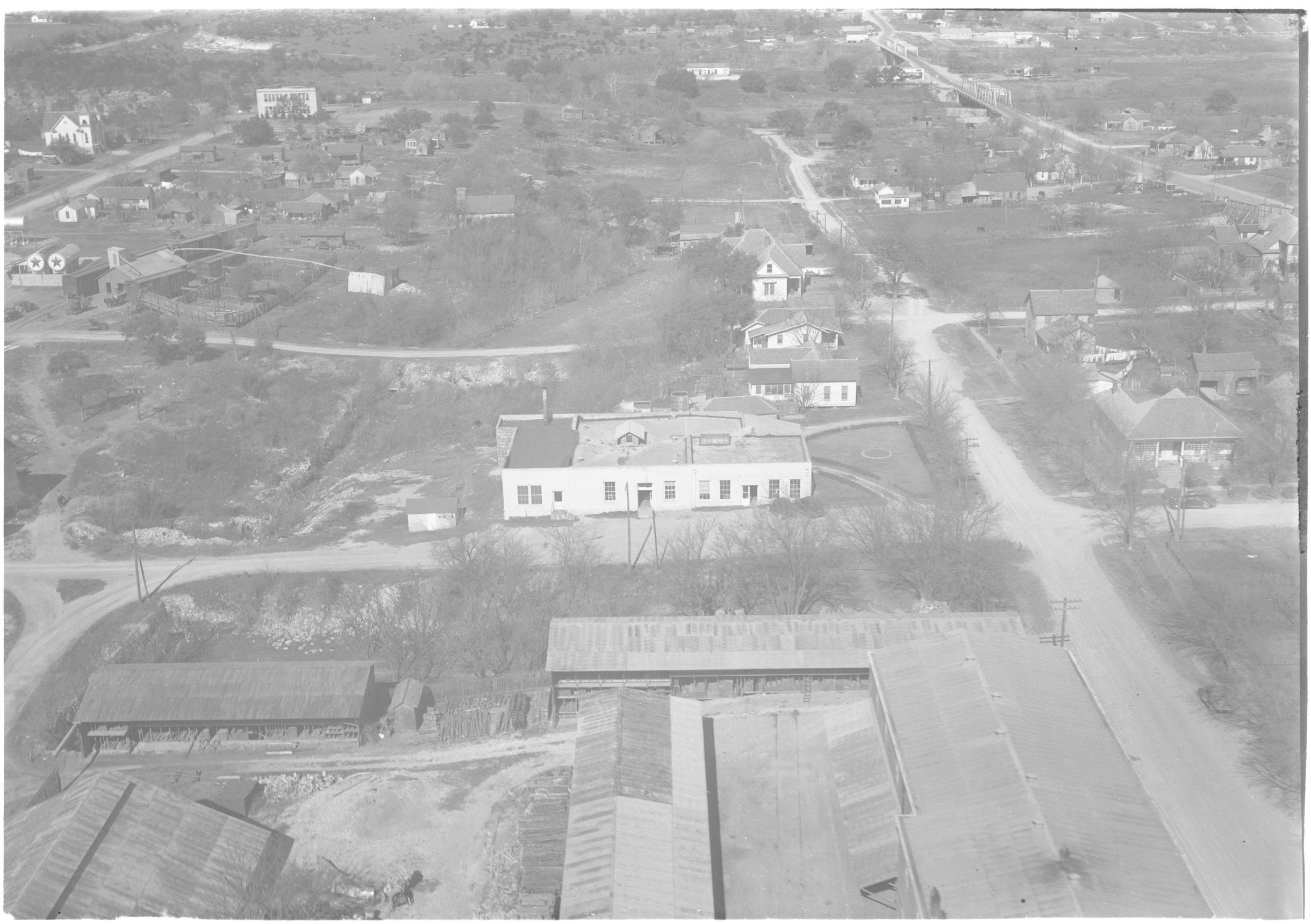
Aerial Photograph Collection, Special Collections & Archives, Southwestern University, Georgetown, Texas
History of the TRG neighborhoods
The Shotgun House Museum sits within the neighborhood historically known as the Track, Ridge, Grasshopper neighborhoods, or TRG. The TRG has been designated as a Small Area Plan as efforts are made to preserve the history and culture of this special neighborhood area.
Georgetown incorporated in 1848. The area was previously inhabited by the Native Tonkawa tribe. The region was controlled for a time by Spain before Mexico won its independence. Eventually, the Republic of Texas formed after separating from Mexico in 1836. The TRG, originally three separate and distinct neighborhoods Track, Ridge and Grasshopper, were established prior to the 1870s. The Ridge and Grasshopper Neighborhoods, located north of the current University Avenue/State Highway 29, developed to the west of the Downtown area and along the eastern curve of the San Gabriel River. The Track neighborhood developed southwest of downtown along the rail line and close to the cotton gin and oil mill, which provided employment opportunities for early residents.
Under Mexican law in the early 1800’s and after the Civil War, there was a significant population of free Blacks in Texas. The Black community created autonomous community institutions, such as churches and schools. Evidence of these establishments in the early days of the area that would become the TRG can be found in existing structures as well as Georgetown city records. Wesley Chapel A.M.E. Church congregation organized in 1869, just west of Georgetown’s Courthouse Square. A photo from circa 1878 shows the St. Paul United Methodist Church building in the background along what is now Martin Luther King Jr. Street. The congregation is currently in its third building in the same location.
Sanborn Fire Insurance maps dating to 1889 show “Negro Tents” on blocks west of the railroad track that terminated at George Irvine’s lumber yard, which later became the noted Belford Lumber Yard. Sanborn Maps from 1894, 1900, 1905, 1910 and 1916 show residential development west of the railroad tracks, with St. Paul included in the map area for the first time in 1900, noted as a “Negro Church” on Timber Street, which is now Martin Luther King Jr. St. The 1916 map expanded to show the initial “High School (Negro)”, “Macedonia Baptist Church (Negro)”, “Wesley Chapel A.M.E. Church”, “Friendly Will Baptist Church (Negro)” and “Masonic Hall (Negro)” and “Odd Fellows Lodge Hall (Negro)”, reflecting the separate church and civic groups in a segregated Georgetown. The individual listing of these structures on the Sanborn maps highlights the presence of the African American community and the importance of the structures to the early built environment of the City of Georgetown. Although the neighborhood was primarily African American, it was not exclusively so, and the three neighborhoods combined were the home of white and Mexican American residents as well. The 1925 Sanborn Map illustrates a larger expanse of the TRG neighborhood, including houses west of the rail tracks, the Mexican Methodist Church at 9th Street and Laura Place (what is now Bridge Street) and at the Mexican School at the west end of 10th Street next to the river bluffs. By this time several African American church congregations had constructed prominent wood buildings, purchasing lumber and materials from the Belford Lumber Company.
The Blue Hole served as both a swimming hole and a sacred place for baptisms in the community through the mid-20th century. City parks and swimming areas remained segregated until civil rights legislation desegregated public facilities.
In 1968 the City of Georgetown adopted the Urban Renewal Plan for the area of town west of the railroad tracks. Overseen by the Urban Renewal Agency, the plan effected the acquisition and demolition of dozens of properties across the neighborhoods, with new streets, lots and houses developed to meet newly adopted zoning standards. The plan resulted in the relocation of residents, demolition of historic and culturally important structures and followed on the relocation of the Marshall Carver High School from the north end of the neighborhood near Blue Hole to the southwest end of town and a new school constructed as the segregated high school shortly before Brown v. Board of Education was implemented and desegrated schools. A thriving African American business community was recorded in a document published by the Gay Hill Missionary Baptist Church (now Calvary Hill), which provided a church history, a history of notable members and an accounting of the businesses in the TRG neighborhood at the time, which included a gas and filling station, a funeral home, a meat market, a grocery store, a barber shop, a tailor, a beauty shop and several cafes. Other notable persons included contractors, carpenters, plumbers and athletes.
Today the neighborhoods reflect a mix of historic structures with a dominant development pattern of single-family homes constructed during Urban Renewal in the north part and public and multi-family housing developments in the south part. The Historic A. M. E. Church remains, but most of the historic church buildings have been demolished and replaced with new structures either in the historic location or new locations in the neighborhood.
Source: City of Georgetown Planning Department